
Antarctica is one of the least understood continents on Earth, because
99.6% of its surface is covered by ice up to 4.8 km thick. There is increasing
international awareness of the pivotal role that Antarctica plays in the global
climate and geodynamic systems.
The stability of Antarctic ice sheets in a warming climate is of significant
societal relevance because of its repercussions on global sea-level rise. Airborne
geophysics is a prime tool to explore ice sheets, image subglacial environments
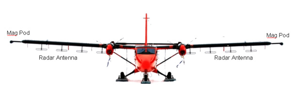
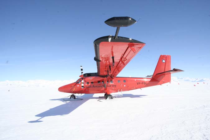
and to study associated geological features. The British Antarctic Survey has
recently been at the forefront in developing an enhanced aerogeophysical platform
(installed in a Twin Otter), comprising airborne radar, aeromagnetic and aerogravity
sensors.
 |
 |
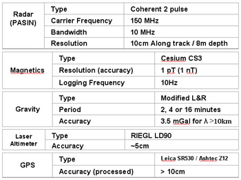 |
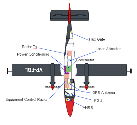
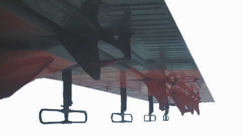
Radar
The HF radar is an in house system (PASIN) and capable
of surveying ice surface, ice thickness, bedrock configurations, internal ice
layering and subglacial lakes. PASIN, BAS's in house developed radar is a 2
pulse coherent system with a frequency of 150MHz, capable of either conventional
or polarimetric operation. It has a bandwidth of 10MHz limited mainly by the
folded dipole aerials.
Along-track resolution of ~10cm is achieved. Post-processed resolution is usually
set to about 1m. Depth resolution is governed by pulse type, period and bandwidth.
With this system it is typically 8m. Data is stored on dual-redundant removable
media. For a 4.5 hour flight will generate around 150GB of data.
Magnetics
VP-FBL flies a magnetics system in a fixed wing configuration, which greatly improves our field operations. As the aircraft is in a fixed wing configuration a 3-Axis fluxgate and post processing remove the errors caused by eddy current in the airframe and distortion of the field by the aircraft. BAS use an off the shelf magnetics system from Pico Envirotec, AGIS ((Airborne Geophysical Information System). The system provides synchronised logging for two CS3 cesium magnetometers, three-axis fluxgate magnetometer, radar altimeter, attitude heading and attitude from the aircrafts avionics. Magnetic data is logged at 10Hz and synchronises the data to the 1pps. The cesium 3 magnetometers used realise a resolution of 1pT and an accuracy of 1nT.
Gravity
Aerogravity measurements are acquired with a modified LaCoste and Romberg
air/sea gravimeter
Modifications were carried out by ZLS in Austin Texas to allow for digital data
acquisition and improvements to the stabilised platform. The meter platform
is mounted at the centre of motion of the Twin Otter. The platform is stabilized
using two high performance optical gyros, plus two accelerometers and two torque
motors. BAS operate the platform at a 4-minute period. After processing the
accuracy is better than 3.5 mGal for wavelengths greater than 10 km.
Further
details of the Gravimeter
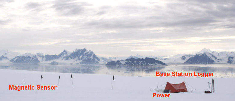
Ground Base Stations
The data processing relies on ground base stations to
provide reference data.
A magnetic base station monitors temporal variations in magnetic field in a
magnetically quite area.
The base stations logging and power supply is positioned well away from the
sensor.
We also set up Leica GPS base stations to provide ground base reference for
the roving Leica GPS mounted in the aircraft for the DGPS processing.
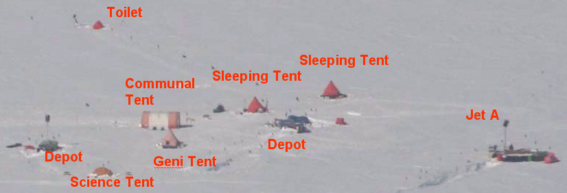
A Typical BAS Field Camp
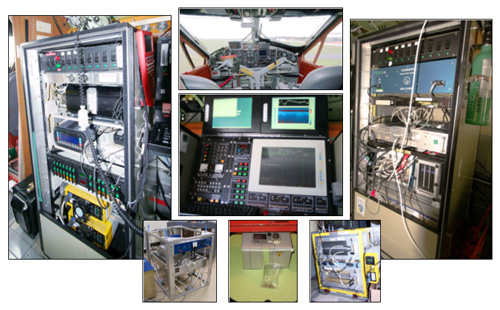
BAS operates its field camps very efficiently compared to some countries, they are comfortable enough to allow the science to be easily carried out and not extravagant as to need a large effort to set up the camp.
| Zero Longitude |